


Runoff Calculator Page 1: Soil Data
This webpage is here to help you find the Hydrologic Soils Group of your property. The type of soil is critical to determining the amount of runoff because certain soils allow rain water to infiltrate easier than others. A common way that Civil and Environmental Engineers classifiy a soil's infiltration capabilities is by assigning the soil a grade of either "A" , "B", "C", or "D".
A soils infiltrate rain water the best, and therefore properties with an A soil generate the least amount of runoff. D soils have the lowest infiltration rates, and therefore contribute the most runoff
The table below summarizes some of the physical properties of the Hydrologic Soils groups:
| Soils Group | Infiltration Rate(in/hr) | Relative Runoff Potential |
| A | >.30 | Low |
| B | 0.15-.30 | Moderate |
| C | 0.05-0.15 | High |
| D | 0-0.05 | Very High |
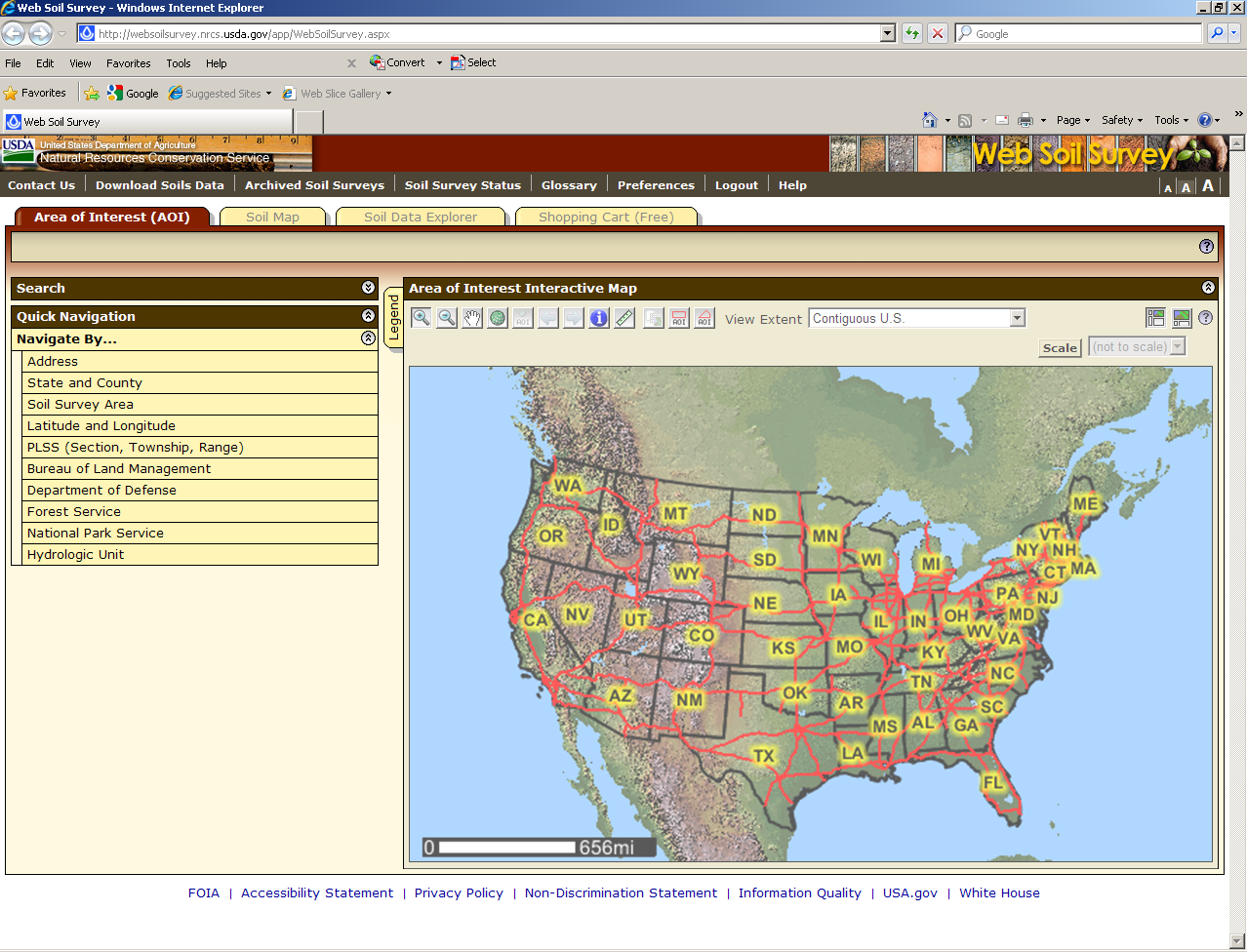
Figure 1: Screen Shot of NRCS's WSS
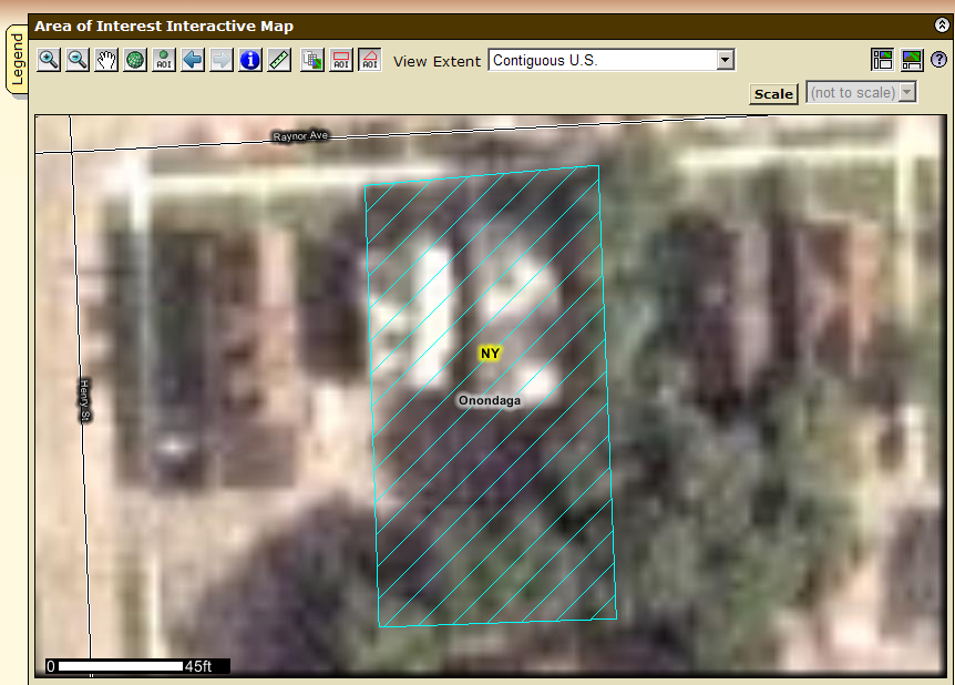
Figure 2: Example of Completed Area of Interest
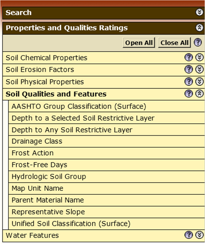
Figure 3: Navigation Menu
Follow these steps to determine what is the percentage of area of your property that falls into each Hydrologic Soils Group.
If you are struggling with this section, you can use the deafult values that appear in the form when the page loads. To do this, simply hit the "Submit" button in the form at the bottom of the page.
Step 1:
Another widow should be open to a new session with the National Resource Conservations Service's (NRCS) Web Soil Survey. If it did not, click here. You should be taken to a map and explorer. This application can be used to determine various soil data for areas across the entire country. While there is a wealth of information available through this application, we are only concerned with the Hydrologic Soils Group.
The application should look like "Figure 1."Step 2:
On the left navigation menu of the WSS application, under "Quick Navigation" select "Navigate By... >> Address."
Enter your address in the fields provided and click "View". The map on the right should bring you to your property. It may take minute, so please be patient. Once your address has been located, use the zoom buttons , or the pan tool
  change the view of the map until your whole property is clearly in view.
Step 3:
Trace the extents to your property, also referred to as the "Area of Interest" (AOI), using the AOI tracing button . To do this, click on all of the corners of your property. Each time you click on the map, a new vertex will be added to the polygon tracing your property. When you are ready to finish tracing your property, double click on the last vertex. This should close the polygon, and you should see that application is processing your request. Once it is done, a polygon with a light blue border and hash-fill should appear on the map. See Figure 2 for an example. If you are happy with the trace of your polygon, move on to Step 4. If not click the Area of Interest Trace button again and start over.
Step 4:
Click the "Soil Data Explorer" tab at the top of the application window.
Once the page refreshes, click the "Soil Properties and Qualities" subtab, located at the top of the map window.
Step 5:
Click the "Qualities and Features" option in the navigation menu on the lefthand side of the application (See Figure 3 for example of this navigation menu). A new series of options should be displayed below the "Qualitites and Features" selection. Click on "Hydrologic Soils Group".
You are now prompted to select how you want your results displayed. Leave these options in their default settings. Click the "View Rating" button below these options. The page should refresh after you have done this.Step 6:
Scroll down until you locate the table of soil properties in the application window. This table contains information about all of the different soil types found on your property. Each row in the table represents a different soil type found on your property.
The columns in this table are: Map Unit Symbol, Map Unit Name, Rating, Acres in AOI, and Percent of AOI.
The Hydrologic Soils Group for each soil type is located in the "Rating" Column. Identify this "Rating" and the "Percent of AOI" for each soil type in the table.
Note: If one of the soil types is "Urban land" assume that this area it's "Rating" is type D.Step 7:
Now, enter the percent in AOI for each of the soil grades (A-D) in the form below. If there is no coverage of a particular grade, leave the percent coverage as zero. In some cases, only one hydrologic soils group may be present.
Hit submit once all of the coverage percentages have been entered. Note that all of the percentage coverages should add up to 100%.

The sum of your coverage percentages was not equal to 100%. Please try again.