Previous | Next
Ouachita River Reach Profile Exercise
Exercise Objective
To apply Rosgen Level II profile analysis and determine various FGM characteristics on the single threaded Ouachita River reach.
Exercise Process
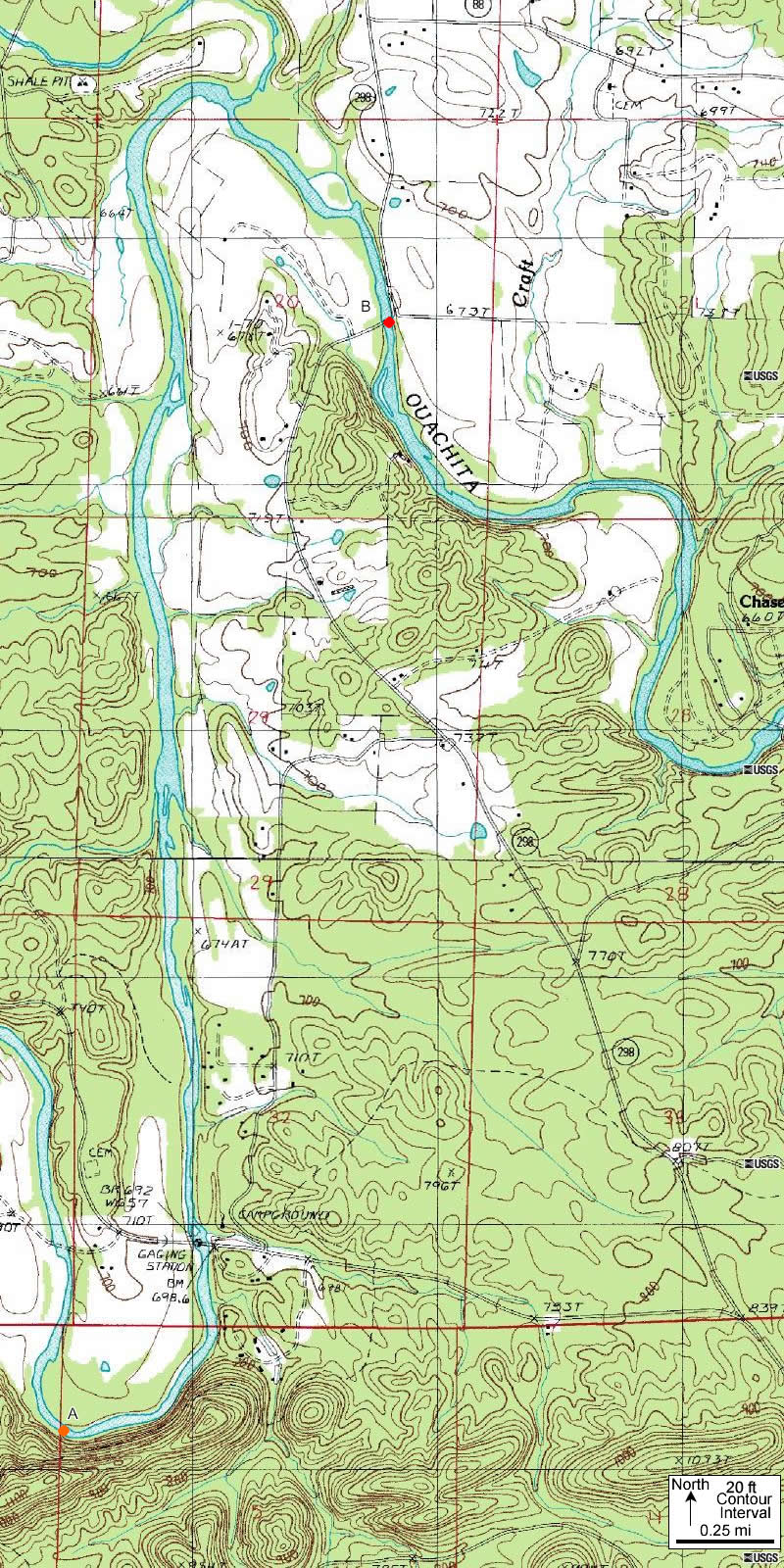
- Obtain a high resolution map of the picture shown on this page by right clicking on the image with your mouse to Save Target As … on your computer. Note the Ouachita River reach of interest between points A and B on this map.
- View the high resolution map 06_55_01a.jpg in ImageJ and determine profile FGM properties. In Level II, morphological parameters measured using the channel profile data are often confirmed and refined by in-field measurements. Since most cannot readily get to this field site, we are providing some data for consideration. Take a moment to review the planview image and note the pattern for the channel, as this will help you critically evaluate the field data provided.
- Measurements were taken for elevation, but distance must be measured.
- Water surface elevation at point A was 709 feet
- Water surface elevation at point B was 671 feet
- Distance between points A and B in feet
- Please save your measurements for future application in this exercise.
- Compute the following:
©
|
|