


Runoff Calculator Page 3: Alaska Precipitation Data
This page will help you determine the precipitation depth of a design storm in your area. The particular storm is one that would last for 24 hours, and has the probability of returning once every 10 years.
This specific storm event is often suggested by design manuals to size stormwater structures to reduce the contribution of runoff volumes to the sewer system.
Thumbnail of Precipitation Map
Step 1:
A PDF document should have loaded in another window. If so, skip down to Step 2. If this document did not load, click here.Step 2:
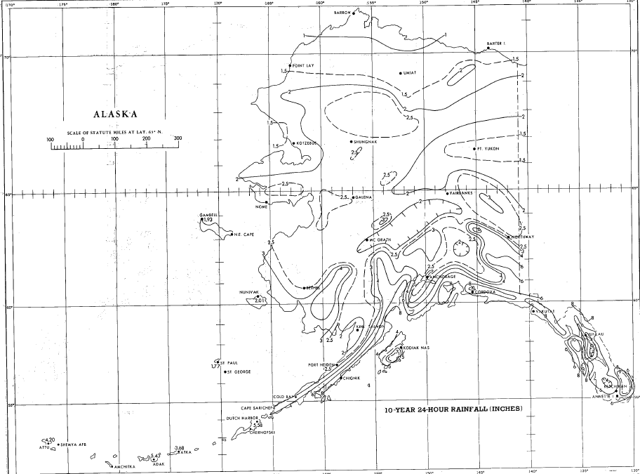
You should now see a map of your state in the PDF viewer (a sample map is shown to the right). Use the PDF viewer to zoom in on your area of the state.Step 3:
Each of the lines is an isopluvial line. These are lines that connect points on a map that have the same precipitation depth during our design rain event. They are similar to contour lines on an elevation map that connection all of the points with the same elevation.To get the precipitation depth needed for the stormwater design calculator, you must first identify which isopluvial lines your property falls between.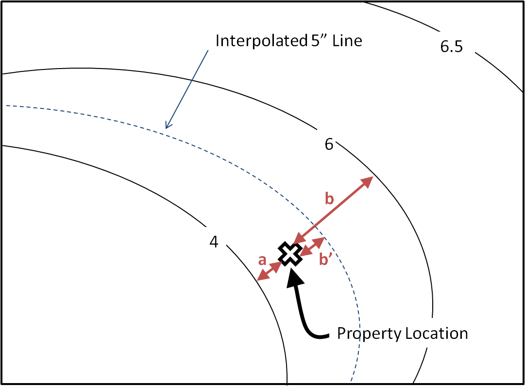
Isopluvial Interpolation Example
Choose the value the best describes your property by interpolating between the isopluvial lines on either side of your property (4" and 6" in our example).
The value should be rounded to the nearest half inch (0.5). To do this, you may need to use a sort of weighted average. In our example, we first see that our property is closer to the 4" isopluvial line than the 6" line (distance "a" < distance "b"). This means our actual value is also closer to 4". Whether or not the value should be 4.0", 4.5", or 5.0" depends on how close it is to the isopluvial line.
If you see the image on the right, our hypothetical property is about halfway in between the 4.0" line on the provided map, and a theorhetical 5.0" line (a = b'). This means the value we would use is 4.5".
Use this procedure to estimate a precipitation depth of your own based on the map in the PDF file.Step 4:
Write down the 24-hour, 10 year percipitation depth you pulled from the map in the form below.
Click submit to see the results of the caluclator!