


Runoff Calculator Page 2: Curve Number
Now that you have determined the type of soils on your property, it is time to determine its Curve Number.
The Curve Number is an empirical value created by the NRCS the is used to estimate how much rain water will infiltrate into the ground, and how much will not and turn into runoff. Factors that affect the curve number are:
- Hydrologic Soils Groups: Determines how well the soils allow water on the land surface to enter into the subsurface
- Existing Soil Moisture Conditions: Based on the precipitation that occurred on the days prior to the design storm. The wetter the soil, the more runoff.
- Land Cover Type (including impervious cover fraction): Land use patterns, such as vegetation type and density, affects how easily water sheds off a property.
- Hydrologic Connectivity: If large amounts of impervious areas are connected directly to channels that lead to the sewer system they will produce flashier runoff events.
Curve numbers range from 35-98. A lower curve number means less runoff, and a higher number means the opposite. An urban area that is covered entirely by rooftops and roadways will have the highest curve number of 98. Some ways to lower the curve number in these dense, urban areas are to plant street trees, install green roofs, or replace parking space with rain gardens or infiltration trenches.
Introduction
Following these instructions will allow you to trace out an area on your property that you wish to capture runoff with a rain garden (refered to as a "Drainage Area").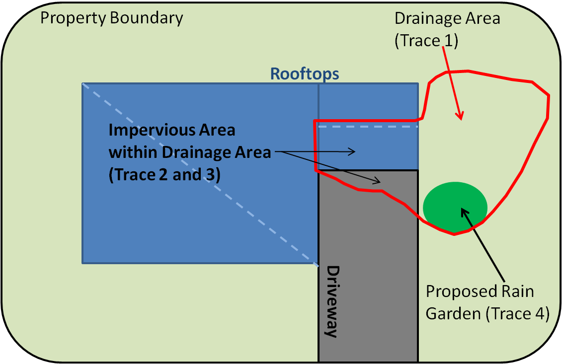
Figure 1: Tracing Example
You will be asked to trace out: the drainage area, the imerpvious surfaces within this area, and the proposed location of a rain garden. An example of how this process may look on a theorhetical property can be seen in the figure to the right.
First, you would trace the drainage area you wish to treat with a rain garden. You will be asked to describe the PERVIOUS area within this drainage area.
Then you will have to trace any impervious surfaces within the rain garden area, and finally outline the rain garden intself.
The instructions below will walk you through this process.Step 1:
Begin Here by typing your address in the search bar below.-
If your specific address does not come up, try using a nearby address and panning over to your property.
Step 2:
Enter number of discrete impervious surfaces (driveways, parking lots, rooftops, garages, sheds, etc). Discrete means that they areas do not drain into one another directly:Step 3:
Now you will begin tracing the extents of the area you wish to treat with a rain garden, as well as impervious surfaces on it. Please refer to the "Instructions" textbox below the map for more detailed directions. The text in this window will update as your move through the tracing process.
Note: Clicking the "Satellite" or "Hybrid" buttons on the map may help you identify your property boundaries