Adirondack Ecological Center
Unit Management Planning

Using GIS to Assist the Inventory Portion of the Adirondack Forest Preserve Unit Management Planning Process
Background
The Adirondack Park is a 6-million acre mosaic of private and state-owned land. The New York State Department of Environmental Conservation (DEC) is responsible for stewardship of roughly 2.6 million acres of public land, collectively called the Forest Preserve. Stewardship of each unit is guided by a Unit Management Plan (UMP), a document that serves as a mechanism to apply the State Land Master Plan to each Unit.
UMPs provide a framework within which DEC land managers inventory natural resources along with present and potential recreation facilities to ensure that these resources are not compromised by overuse or degradation.
The UMP-GIS Consortium is a partnership made of university, government, and non-profit organizations collaborating with the DEC and led by researchers at the Adirondack Ecological Center of SUNY College of Environmental Science and Forestry. The project goal is to provide DEC with an efficient method to access and evaluate existing inventory data using a Geographic Information System (GIS). The result will be a coordinated approach to better land use planning in the Adirondacks.
UMP-GIS Project Objective
Within the project goal are four objectives:
- Assemble a GIS database describing the ecological content of the units and adjacent lands.
- Interpret the context of the unit within the surrounding landscape.
- Provide training to DEC planners to enable future interpretation of GIS data.
- Ensure protection and archival of the data.
UMP-GIS Projects
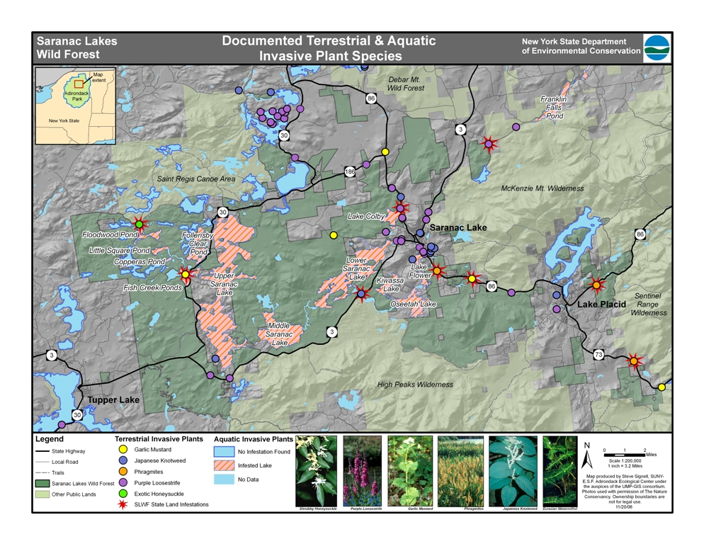
Monitoring Invasive Species
Invasive species have become a major concern for Adirondack Park managers. The map below is one of a series showing invasive plant infestations of immediate concern to the unit in question, as well as other locations in the vicinity.
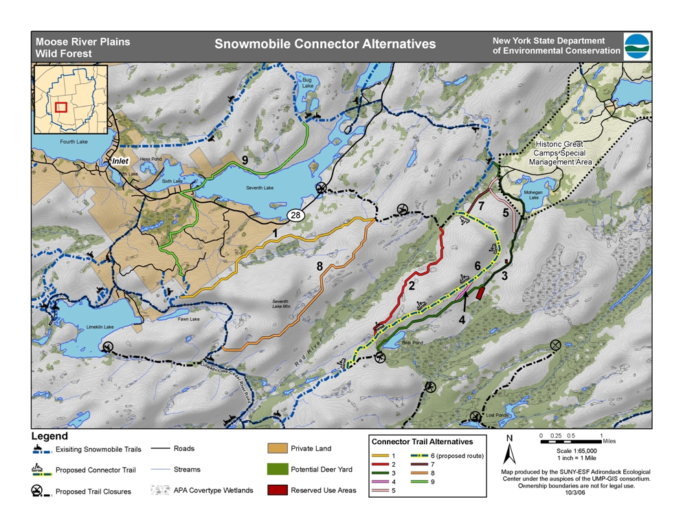
Exploring Trail Placement Alternatives
When planners are faced with locating new sections of trail, GIS can help them identify alternatives that avoid features such as wetlands, Natural Heritage points or high-slope areas. The map below shows several different alternatives for snowmobile "connectors" between the hamlets of Inlet and Raquette Lake, several of which were created with our “least cost path” modeling procedure
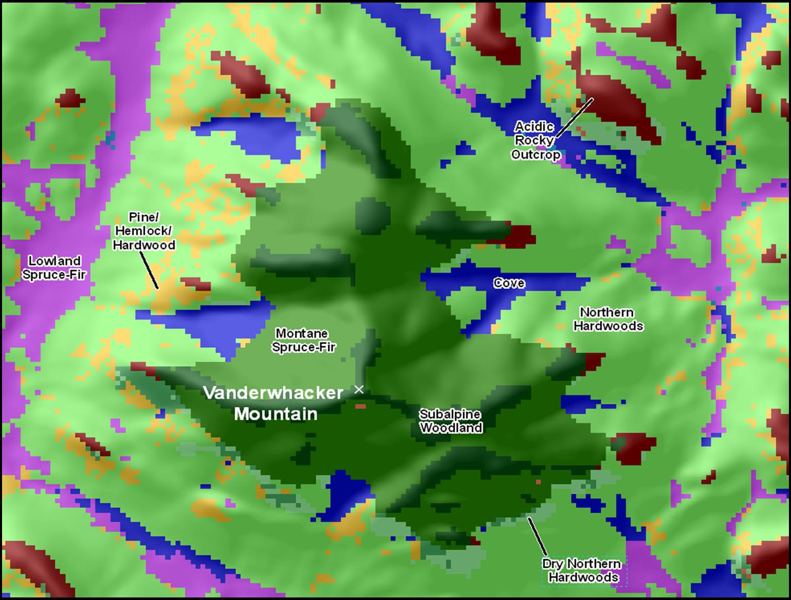
Modeling Adirondack Ecosystems
Invasive species have become a major concern for Adirondack Park managers. The map below is one of a series showing invasive plant infestations of immediate concern to the unit in question, as well as other locations in the vicinity.
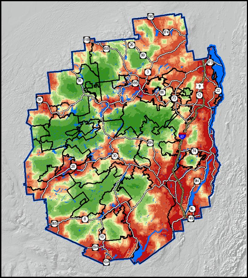
Contextual Analysis
We use GIS to produce maps showing spatial patterns of natural features, human impact and recreational opportunities in the Adirondacks. For example, we used several datasets to produce an index of human impact within the park (below).Red denotes areas of greater human impact.
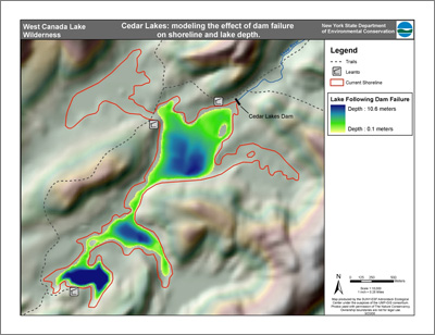
Modeling the effects of dam failure
Using bathymetry maps from the Adirondack Lakes Survey Corporation, we use GIS to predict changes in shoreline and lake depth if deteriorating dams were to fail. The map below was created for the West Canada Lake Wilderness unit management plan.
UMP-GIS Report
For more information, contact Stacy McNulty