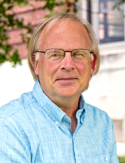
Faculty Profile
Stephen Stehman


Distinguished Teaching Professor
Department of Sustainable Resources Management
322 Bray Hall
Highest Education
Ph.D., Cornell University (Biometry), 1990.
Areas of Study
Environmental sampling, sampling design and analysis for land-cover monitoring
Courses Taught
- APM 620 Experiment Design and Analysis of Variance (Spring semester)
- APM 625 Sampling Techniques (Fall semester)
- APM 671 Map Accuracy Assessment
Recent Publications
Stehman, S. V., Fonte, C. C., Foody, G. M., and See, L. (2018). Using volunteered geographic information (VGI) in design-based statistical inference for area estimation and accuracy assessment of land cover. Remote Sensing of Environment, 212, 47-59.
Wickham, J., Stehman, S. V., Gass, L., Dewitz, J. A., Sorenson, D. G., Granneman, B. J., Poss, R. V., and Baer, L. A. (2017). Thematic accuracy assessment of the 2011 National Land Cover Database (NLCD). Remote Sensing of Environment, 191, 328-341.
Boschetti, L., Stehman, S. V., and Roy, D. P. (2016). A stratified random sampling design in space and time for regional to global scale burned area product validation. Remote Sensing of Environment, 186, 465-478.
Cohen, W. B., Yang, Z., Stehman, S. V., Schroeder, T. A., Bell, D. M., Masek, J. G., Huang, C., and Meigs, G. W. (2016). Forest disturbance across the conterminous United States from 1985-2012: The emerging dominance of forest decline. Forest Ecology and Management, 360, 242-252.
Potapov, P. V., Dempewolf, J., Talero, Y., Hansen, M. C., Stehman, S. V., Vargas, C., Rojas, E. J., Castillo, D., Mendoza, E., Calderón, A., Giudice, R., Malaga, N., and Zutta, B. R. (2014). National satellite-based humid tropical forest change assessment in Peru in support of REDD+ implementation. Environmental Research Letters 9(2014) 124012 (13pp), doi:10.1088/1748-9326/9/12/124012.
Stehman, S. V. (2014). Estimating area and map accuracy for stratified random sampling when the strata are different from the map classes. International Journal of Remote Sensing, 35, 4923-4939.
Stehman, S. V. (2013) Estimating area from an accuracy assessment error matrix, Remote Sensing of Environment,132, 202-211.
Hansen, M.C., Potapov, P.V., Moore, R., Hancher, M., Turubanova, S.A., Tyukavina, A., Thau, D., Stehman, S.V., Goetz, S.J., Loveland, T.R., Kommareddy, A., Egorov, A., Chini, L., Justice, C.O., Townshend J.R.G. (2013) High-resolution global maps of 21st-century forest cover change, Science, 342 (6160), 850-853.
Sleeter, B. M., Sohl, T. L., Loveland, T. R., Auch, R. F., Acevedo, W., Drummond, M. A., Sayler, K. L., and Stehman, S. V. (2013) Land-cover change in the conterminous United States from 1973-2000, Global Environmental Change, 23, 733-748.
Hansen, M. C., Stehman, S. V., and Potapov, P. V. (2010) Quantification of global gross forest cover loss, Proceedings of the National Academy of Sciences, 107, 8650-8655.
Stehman, S. V., and Selkowitz, D. J. (2010) A spatially stratified, multi-stage cluster sampling design for assessing accuracy of the Alaska (USA) National Land-Cover Data (NLCD), International Journal of Remote Sensing, 31, 1877-1896.
Stehman, S. V. (2009) Model-assisted estimation as a unifying framework for estimating the area of land cover and land-cover change from remote sensing, Remote Sensing of Environment, 113, 2455-2462.
Stehman, S. V. (2009) Sampling designs for accuracy assessment of land cover, International Journal of Remote Sensing, 30, 5243-5272.
Stehman, S. V., Sohl, T. L., and Loveland, T. R. (2003) Statistical sampling to characterize land-cover change in the U. S. Geological Survey land-cover trends project, Remote Sensing of Environment, 86, 517-529.
Current Graduate Advisees
 Oswaldo Carrillo
oicarril@syr.edu
- Degree Sought: PHD
- Graduate Advisor(s): Yanai and Stehman
- Area of Study: Forest Resources Management
Personal Statement
Oswaldo Carrillo has a master's degree in applied statistics from the Colegio de Postgraduados, he has 10 years of experience in the area of Monitoring, Reporting and Verification (MRV) for REDD+. He has carried out different statistical analyzes on MRV for REDD+ and has carried out MRV trainings in different countries in Latin America, Africa and Southeast Asia. From 2016 to 2021, he was the head of CONAFOR's MRV system for REDD+, in which he coordinated the preparation of two national GHG inventories in the land sector, a national Forest Emission Reference Level (NREF), a subnational Forest Reference (NRF), a national REDD+ performance report, among others. He is an active member of the roster of experts of the United Nations Framework Convention on Climate Change for the technical assessments of FREL / NRF. Currently, he is a member of the Latin-American and Caribbean SilvaCarbon team (through the US Forest Service) as a Latin America SilvaCarbon Greenhouse Gas Estimation Statistical Expert and he is a doctoral student at the Environmental Sciences and Forestry Collage of the State University of New York.
Graduate Research Topic
Methods to improve uncertainties estimation of land GHG emission reductions
 Leslie Morrison
lmorri19@syr.edu
- Degree Sought: PHD
- Graduate Advisor(s): Stehman and Drake
- Area of Study: Forest Resources Management