SUNY ESF
The Ecological Scorecard Project

SUNY ESF’s Adirondack Ecological Center partnered with the New York State Department of Environmental Conservation in 2019 to implement the Ecological Scorecard project. Since 2020, we have sampled multiple points of interest used for recreation in order to assess how the park’s natural and recreation resources are responding to visitor use.
This long-term monitoring project assesses how selected recreation areas may be changing over time. Identifying trends in such areas alongside visitor use allows for evidence-based management, with continued monitoring of how such management action may lead to improved ecological outcomes.
Sampling sites
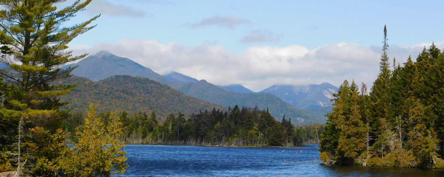
Sampling takes place at points of interest used for recreation (i.e., campsites, lean-tos, and trails), as well as an under-construction trail not currently open to the public, and two non-recreation control sites in ESF’s Huntington Wildlife Forest in Newcomb, NY. Recreation sites are on DEC lands designated as Wilderness, Wild Forest, or Primitive Area.
Methods
At each point of interest, we monitor a suite of ecological indicators from which inferences on recreation can be made. We conduct vegetation sampling within randomly sampled quadrats, measure vertical structural complexity (a measure of understory vegetation coverage) along randomly sampled transects, conduct standardized surveys for salamanders, invasive earthworms, ticks, and loons, and visually search sites for the presence of invasive plant species and forest pests. We also passively collect audio data and monitor change at standardized photo-points. At streams near points of interest, we complete macroinvertebrate surveys to infer water quality.
Indicators that suggest impacts from and to recreation:
- Ticks at trailheads and edges of parking areas.
- Presence of invasive earthworms
- Increased coverage of certain ground cover types (e.g., bare soil, rock).
- Negative correlation between wildlife vocalization and human sounds.
- Presence of invasive plants and forest pests.
- High representation of pollutant-tolerant macroinvertebrates within stream communities.
Indicators that suggest limited recreation impact:
- High relative density of salamanders
- Increased coverage of plants that are sensitive to trampling such as moss and forbs.
- No decrease in vertical structural complexity.
- Presence of Common loons at sites with adjacent lentic waters.
- High representation of pollutant-sensitive macroinvertebrates within stream communities.
Analysis and Scoring
Trend analyses to monitor change in indicators through time are ongoing. Methods used to monitor change relevant to recreation include comparison of recreated sites with control sites and comparison of cover/structure sampled adjacent to points of interest (near plots) with cover/structure sampled 100m from the point of interest (i.e., a distance that likely receives less use).
We assign each site a score based on a semiquantitative index to summarize its current condition and changes in its condition across time. The index weighs quantitative ecological indicator data and qualitative information such as visually apparent change in erosion and presence of trash in recreated sites.
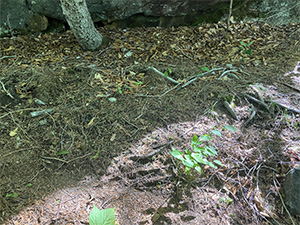
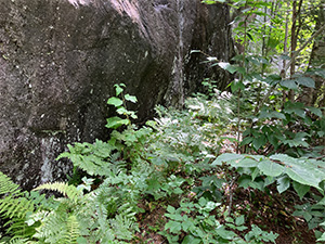
Photopoint monitoring at a site in Adirondack Park used for rock climbing. Evidence of erosion and hindered vegetation growth is visible on the left, whereas an unused section at the base of a rock wall supports vegetative growth on the right.
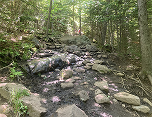
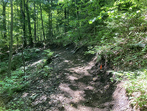
On the left, a frequently used trail (Cascade Mountain), exhibits exposed rocks, soil erosion, and compaction from high visitor use. On the right, a recently constructed trail with a flattened grade that is not currently in use will mitigate erosion potential once used for recreation.
Visitor Use Management
Visitor Use Management ("VUM") is the proactive and adaptive process for managing visitor use on public lands with a variety of strategies and tools to achieve and maintain desired resource conditions and visitor experiences. For more information, visit NYSDEC's website.